
Why Pennsylvania needed it
Before Altoona existed, the state of Pennsylvania had already found a way over the Allegheny Mountains. It was the Allegheny Portage Railroad, and its story explains both why the Pennsylvania Railroad chose the Logan Valley and why Horseshoe Curve mattered so much. This page relies mainly on the National Park Service, which runs the Allegheny Portage Railroad National Historic Site.
In the early 1800s, the Park Service explains, goods moved across Pennsylvania by Conestoga wagon, and the trip from Philadelphia to Pittsburgh took 23 days when the dirt roads were in good condition. In the mid-1820s New York built the Erie Canal, and trade that might have passed through Pennsylvania began to move north instead. Pennsylvania answered with a canal system of its own. In February 1826 the legislature authorized the Main Line of Public Works, a chain of canals and railroads from Philadelphia to Pittsburgh.
There was one obstacle no canal could cross: the Allegheny Mountains. The first idea, according to the Park Service, was a tunnel of about four miles under the mountain, but it was judged too costly and uncertain; tunnelling was new, and nobody was sure a tunnel could hold water. The state chose a railroad instead.
How the inclined planes worked
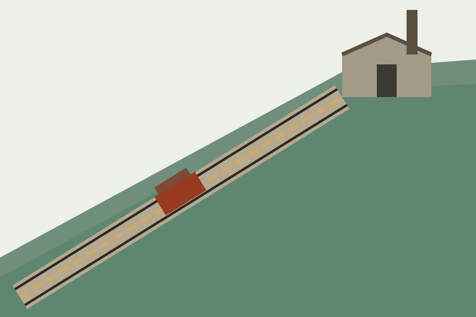
Locomotives of the 1830s could not pull loaded cars up a steep mountainside. So the Portage Railroad used ten inclined planes, five rising on the eastern side of the mountain and five descending on the western side, on a model taken from a similar system in England. At the head of each plane a stationary steam engine drove an endless rope that hauled the cars up the slope. Locomotives were used only on the flatter stretches between the planes.
The Park Service's geodiversity atlas for the site adds the scale of the problem. The mountains along the route range from about 1,135 to 2,408 feet above sea level, and once the railroad was built it carried canal boats across slopes steeper than five degrees. The barrier was the Allegheny Front, the escarpment described on the geography page; the atlas calls it the reason the Portage Railroad was built at all.
The route over the summit
The Portage Railroad was 36 miles long. It ran from the canal basin at Hollidaysburg, on the eastern side of the mountain, to the basin at Johnstown on the western side, where canals carried traffic on to Pittsburgh. It officially opened on March 18, 1834. With it in place, the Park Service says, the journey from Philadelphia to Pittsburgh took about four days instead of more than three weeks.
The Park Service gives two cost figures: $16,504,655.84 for the whole Public Works system, and $1,828,461.38 for the railroad section. The system carried raw materials east and manufactured goods west, and the Park Service credits it with helping start an era of prosperity in the state.
Worked example
This is an illustration of the Park Service's figures, not a timetable. A shipment leaving Philadelphia for Pittsburgh before 1834 might spend 23 days on the road by wagon. After 1834 the same trip on the Main Line, including the climb over the summit on the inclined planes, took about four days. In 1854 the Pennsylvania Railroad's through line, using Horseshoe Curve, cut the passenger journey to about thirteen hours, according to the Pennsylvania Historical and Museum Commission marker essay for Altoona.
Who used it
The Park Service describes the Portage as serving very different travellers: merchants moving goods, ordinary passengers, enslaved people seeking freedom, and soldiers bound for the Mexican War. It was the first railroad to cross the Allegheny Mountains and the final link that made the Main Line a single route between Philadelphia and Pittsburgh.
The Park Service's account of the route also notes that the whole system involved changing between canal and rail several times; the new Pennsylvania Railroad, by contrast, needed no inclines and no switching between the divisions of the canal.
Overtaken by the railroad
The Portage Railroad operated for a little over twenty years, from 1834 to 1857. Its end came from Altoona. On February 15, 1854, the Pennsylvania Railroad completed Horseshoe Curve and with it a continuous line from Philadelphia to Pittsburgh. A railroad with no inclined planes and no changes of mode took traffic away from the state system, which was already losing money.
The state had been trying to sell the canal system for years. The Park Service records offers of sale under acts of 1844 and 1854 that found no buyer, and a further failed attempt a year later. After some persuasion by the Pennsylvania Railroad, the legislature passed an act on May 16, 1857, and the railroad bought the canal system for $7,500,000, a price the railroad itself set. The sale took place on June 25, 1857, and the company took possession on August 1, 1857.
What it meant for Altoona
For Altoona the Portage Railroad was both a reason for being and a rival. The Historic American Buildings Survey report on the city, held by the Library of Congress, notes that the Main Line Canal crossed the southern end of the Logan Valley where boats began their ascent on Portage cars, and that the Pennsylvania Railroad planned from the start to use the Portage as a temporary connection over the mountains.
The background essay for the Pennsylvania Historical and Museum Commission marker titled "Altoona" explains why the arrangement did not last. The company's chief engineer, J. Edgar Thomson, disliked depending on a state railroad that suffered from delays, breakdowns and political patronage, and he pushed through the borrowing that paid for the company's own line. Once that line opened through Altoona and over the curve, the Portage's days were numbered.
The national historic site
The remains of the Portage Railroad are protected as the Allegheny Portage Railroad National Historic Site, run by the National Park Service. The geodiversity atlas describes the park as stretching about 37 miles through the Allegheny Mountains in Blair and Cambria Counties. Its main unit sits on the divide between the Chesapeake Bay watershed to the east and the Ohio River basin to the west.
The Park Service's home page for the site names several surviving or reconstructed features: an exhibit shelter at the site of Engine House No. 6; the Lemon House, a stopping place for travellers at the summit; the Staple Bend Tunnel near Johnstown, at the top of the first inclined plane; and the Skew Arch Bridge.
Two entries on the Park Service's list of National Historic Landmarks cover the system: the Allegheny Portage Railroad of the Pennsylvania Canal, in Blair and Cambria Counties, dated December 29, 1962, and the Staple Bend Tunnel in Cambria County, dated April 19, 1994. This site does not give opening hours, fees or event details for the park; the National Park Service publishes them.
The story continues: Geography: the Allegheny Front and Blair County