
The gap in the line
Horseshoe Curve is the reason Altoona's railroad history is known well beyond Pennsylvania. It is a great bend of track in a side valley west of the city, built so that trains could climb the Allegheny Front without the inclined planes of the older state railroad. This page draws mainly on the background essay for the Pennsylvania Historical and Museum Commission (PHMC) marker titled "Altoona", dedicated in 1947, which is largely about the curve, and on National Park Service records.
By late 1850, the PHMC essay explains, the Pennsylvania Railroad had built a 132-mile eastern section from Harrisburg to Altoona, and an 85-mile western section from near Johnstown to Pittsburgh. Between them lay the mountain. Closing the gap meant crossing the Allegheny Front, which the essay describes as a 2,300-foot ridge, with deep cuts, high fills and a 3,600-foot tunnel under the mountaintop town of Gallitzin, twelve miles west of Altoona.
The company did not yet have the money for that work, so it used the state-owned Allegheny Portage Railroad as a stopgap to join its two sections. The Portage Railroad page explains how that system lifted cars over the summit on ropes.
Paying for the mountain
The company's chief engineer, J. Edgar Thomson, wanted to end the dependence on the state railroad, which the PHMC essay says was plagued by delays, breakdowns and political patronage, and which slowed the company in its competition with railroads to the north and south. The directors, cautious Philadelphia merchants, would not borrow to finish the line.
Thomson went around them. On February 2, 1852, the morning of the annual stockholders' meeting, he placed newspaper advertisements setting out his case for bonds to cover the roughly $4 million needed to finish the project. The next day a new board elected him president of the company. When the stockholders voted on the bond issue later that year, the essay records 134,680 votes in favour and 754 against. The bonds were issued in September 1852.
The climb west of Altoona
The figures in the PHMC essay show why the mountain section was the hardest part of the line. From Harrisburg to Altoona, 132 miles, the railroad climbed a little more than 800 feet. From Altoona to the summit at Gallitzin it had to climb nearly 1,000 feet more, in just twelve miles. At the summit the track stood 2,161 feet above sea level.
Worked example
This is arithmetic on the figures above, not a measured grade from a survey. Climbing nearly 1,000 feet in 12 miles averages a little over 80 feet per mile. A mile is 5,280 feet, so that is an average rise of roughly 1.6 feet for every 100 feet of track. East of Altoona, 800 feet spread over 132 miles averages about 6 feet per mile. The last twelve miles, in other words, were more than ten times as steep on average as everything before them.
The National Park Service's geodiversity atlas for the Allegheny Portage Railroad explains what the railroad was up against: the Allegheny Front is a sharp escarpment, with about 2,000 feet of elevation change overall, that divides the folded ridges of the Valley and Ridge province from the flat-lying rocks of the Appalachian Plateaus. The atlas names Horse Shoe Curve as one of the geologic features associated with the front. The geography page covers this in more detail.
Why a loop
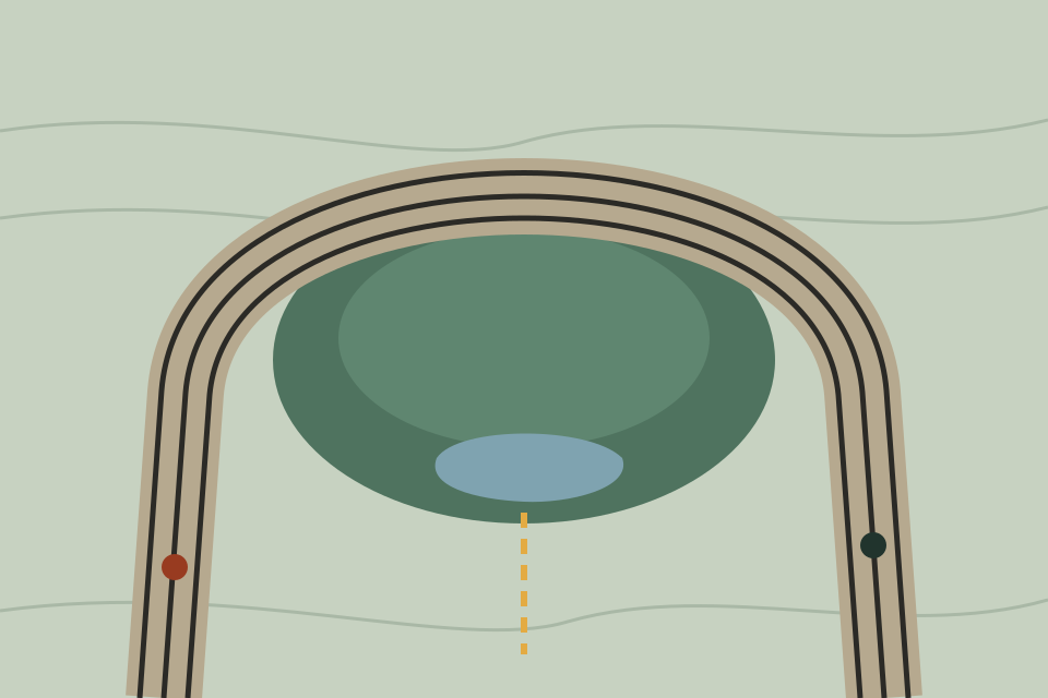
Thomson had a choice, the PHMC essay explains. He could run the line straight at the mountain on a steep grade, or he could take a longer, indirect route that gained height more gently. He chose the second. The line takes a detour of more than a mile up a side valley to a knob called Kittanning Point, swings around the head of the valley, and doubles back along the other side, gaining height all the way.
Building it was heavy work with simple tools. The essay describes labourers with hand tools, mule-drawn carts and explosives cutting, filling and levelling the great curve. At the summit, driving the Allegheny Tunnel was harder still, with repeated rock falls and a roadbed cut into the sides of sheer slopes.
The whole mountain section opened on February 15, 1854. The National Park Service gives the same date for the completion of the curve and of the company's all-rail line between Philadelphia and Pittsburgh. With it, the PHMC essay says, passenger trains could run between the state's two largest cities in thirteen hours, compared with the 3-1/2 days needed on the state's chain of canals and railroads.
The curve in figures
| Measure | Figure |
|---|---|
| Length of the curve | 2,375 feet |
| Distance across the curve | 1,800 feet |
| West side compared with east side | 23 feet higher |
| Distance from Altoona | About five miles west |
| Summit at Gallitzin | 2,161 feet above sea level |
| Allegheny Tunnel | 3,600 feet long |
| Opened | February 15, 1854 |
After 1854
The curve soon became a sight in its own right. The PHMC essay records a small park built in 1880 in the middle of the curve, making it one of the earliest places in America set aside for watching trains, and says that for many years conductors announced the view on daylight passenger trains.
The line was widened as traffic grew. The original double track became three tracks in 1898 and 1899 and four tracks in 1900. In 1957 the company placed a retired Altoona-built K4-class passenger locomotive, No. 1361, on display in the park. Ownership of the track passed from the Pennsylvania Railroad to Penn Central in 1968, to Conrail in 1976 and to Norfolk Southern in 1999. In 1992 the Railroaders Memorial Museum opened a visitor center at the site. At the height of railroad traffic, the essay says, more than 120 trains a day passed over the curve; when it was written, more than fifty still did.
The bend also holds part of Altoona's water supply. The Historic American Buildings Survey report on the city, held by the Library of Congress, records that the city built a reservoir at Kittanning Point, within the bend of the curve, in the late nineteenth century and completed a second there in 1896. The report notes that the reservoirs still served the city when it was written.
Landmark status
Horseshoe Curve is a National Historic Landmark. The National Park Service's list of landmarks by state records it in Blair County with the date November 13, 1966. The PHMC marker essay gives the year as 1964; this site uses the National Park Service date, since the Park Service keeps the official list.
The curve is still a working railroad, which is part of what makes it unusual among landmarks. Visitors watch trains on the same alignment that Thomson's engineers laid out in the 1850s; as the PHMC essay puts it, no one has improved on it since. This site does not list opening hours, admission prices or event dates, which change; the operator publishes its own.
The story continues: The Allegheny Portage Railroad, before the curve